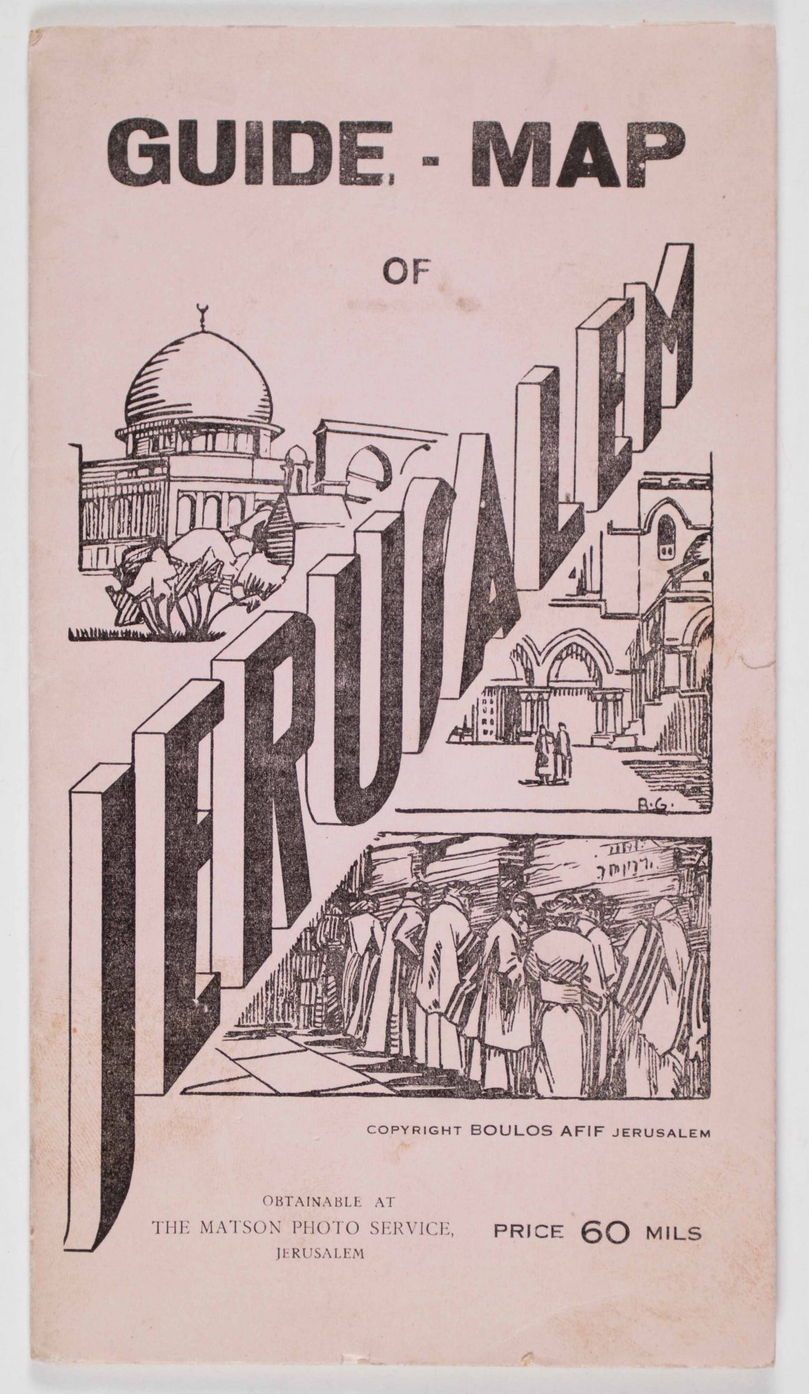
Guide-Map of Jerusalem
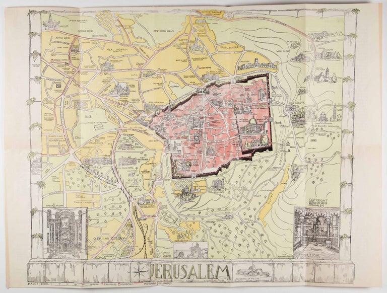
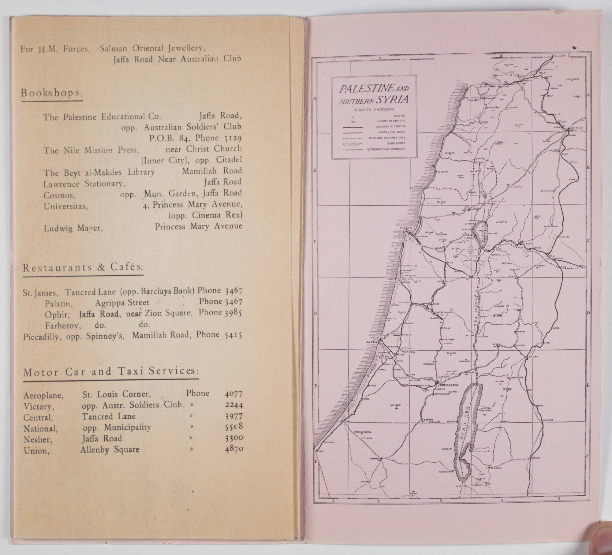
Jerusalem: Boulos Afif, [ca. 1935]. Softcover. Thin octavo. 5pp. [5]. Illustrated pink and black printed wrappers, with black lettering on the front cover. This engaging illustrated color map of Jerusalem dates from the mid 1930s during the British Mandate Period. The map, as well as the illustrations on the front wrapper are the work of German artist Bernhard Gauer (1882-1955). When fully unfolded the map measures 16 3/4x 22 1/2" and is printed at a scale of 1:5000. In addition to showing numerous secular and religious sites inside and outside the walls of the Old City, the map contains separate inset illustrated figures showing the interiors of the Dome of the Rock and the Church of the Holy Sepulchre, as well as the exterior of Rachel's Tomb. The verso of the map contains 10 folded pages of text, 5 of which are numbered and provide background information, and specific text discussing 18 different sites shown on the map. The remaining 5 unnumbered text pages contain other useful tourist and transportation information, including books shops, hotels, holy sites for Christians and Jews, etc. The interior back wrapper contains a b/w map of Palestine an Southern Syria, at a scale of 1:4,000,000. Wrappers with a few small closed tears along the edges, and a few small smudges to the cover. Wrappers in very good, interior and map in near fine condition overall. Protected in modern mylar. vg to near fine. Item #48478
* "For H.M. Forces" (His Magesty's Forces), printed at the top of one of the text pages on the verso.
Price: $350.00